Bend Racing's Technical Endurance Challenge
Late fall and winter tends to offer very little to the adventure racing community, so the TEC (Technical Endurance Challenge) races that Bend Racing offers during the colder months is always a welcome addition to the adventure calendar.
This is the second time I’ve participated in a TEC race as a racer. My second in the same calendar year even. Being still new to the sport, the January 2021 TEC was my first to experience as a racer. I joined my son and two relative strangers to test our skills on the classic rugged terrain packed with elevation gains and losses, flowy single track bike runs and, if you’re fast enough, impressive rock climbing.
Over the year I’ve been learning more about the sport having filmed for five days in central Oregon at Expedition Oregon, as well as competed in my first solo 12 hour adventure with Teton Ogre in eastern Idaho over the summer.
Pre Race
There’s quite a bit of prep work getting ready for an adventure race, even if it doesn’t include packrafts or other water vessels. One would hope that a level of fitness would be already there, then you’ve got to find a team to compete with and ensure you have all the gear (the mandatory, as well as the comforts you like having with you on your journey).
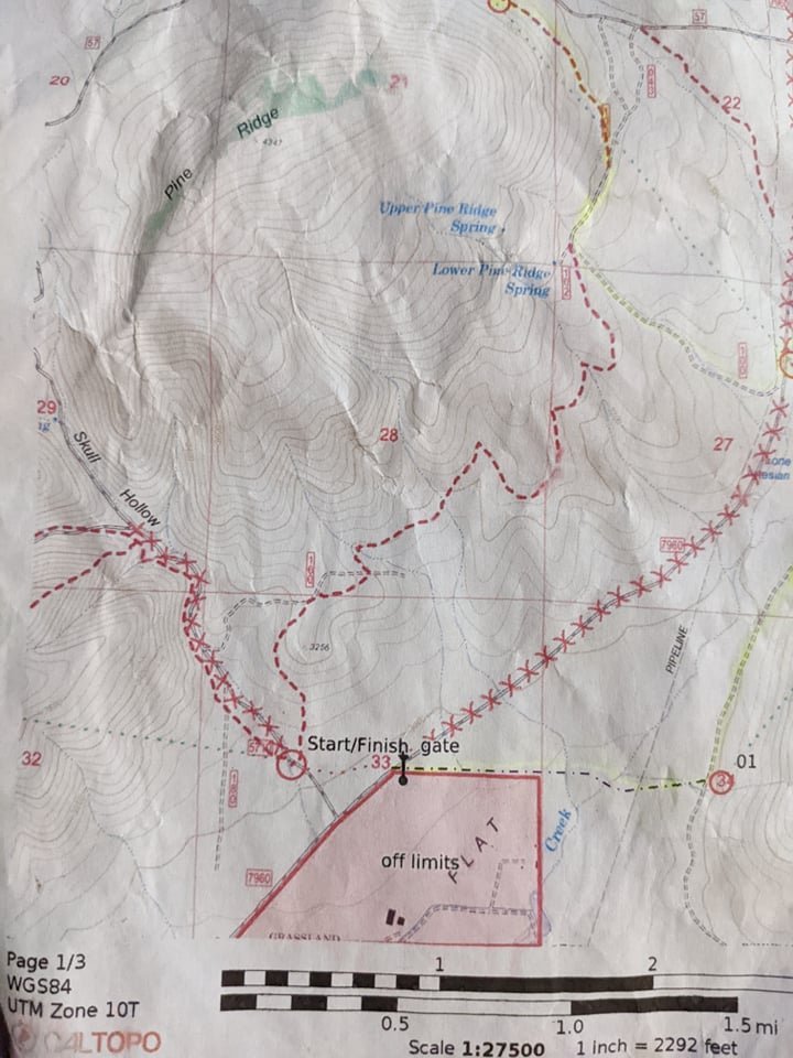
In my case I was on a zoom conversation with the USARA focusing on mid-level racers and got to know Barbara who also lives in the Portland area. We connected online and she invited me to join her team of two others so that we’d make a team of 4. Joining us would be Ernan, a new friend of Barbara’s who also lived in the area and was able to get out at least once to do some training with Barbara. Ella, an experienced orienteering racer from California and childhood friend of Barbara’s, would also be making the journey to Crooked River National Grasslands near Madras and Smith Rock State Park.

(from L to R) Barbara, Tim, Ernan, Ella at the finish line
Barbara was the most experienced of our crew having raced in Expedition Oregon along with the navigator I raced with in the first TEC, Jamaica. Rounding out her team was her brother and husband making up “Lost Boys”. She had been doing quite a bit of work on improving her skills in navigation and was looking forward to pace counting and using the approved non-GPS bike computer to gauge our distances. We met up close to 6AM at my house in east Portland for the drive in my van to the bike drop off site about 2.5 hours away.
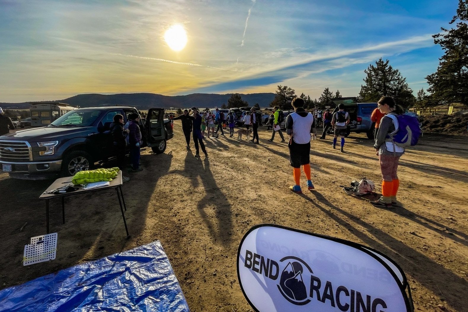

Race Director Jason Magness briefs teams before the start

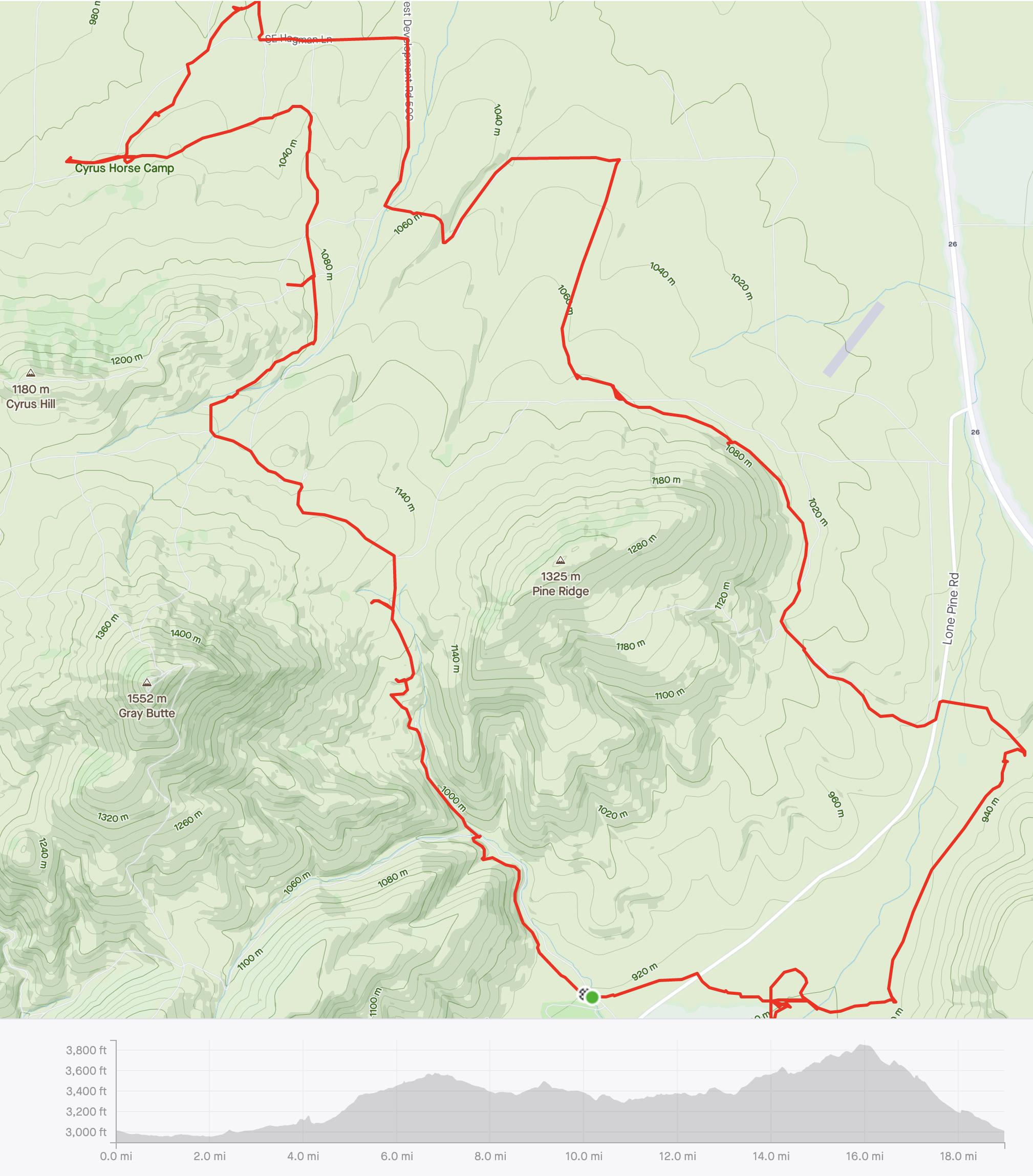
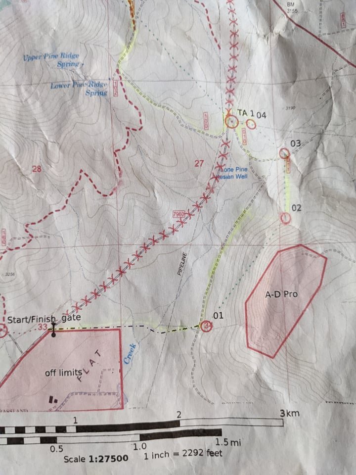
Only receiving our maps within 30 minutes of start, Barbara works to highlight our proposed route taking into consideration the topography, out of bounds and desired team outcomes which will help us determine whether to go for or skip pro points that are more challenging
First Leg: Trekking
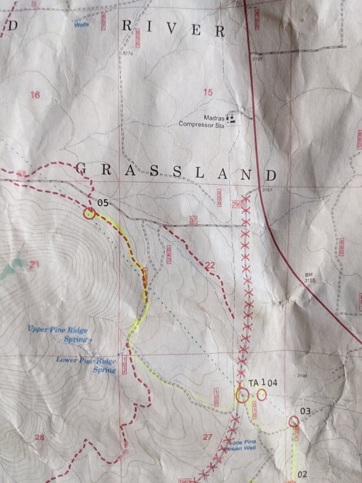
Our team plan was to head from the start straight across the pavement so that we could enter the gate that would take us down a jeep trail to CP (check point) 1. The starts are usually just one big herd taking off together, and this was likely the mentality we got caught up in as we completely forgot to follow our own mapped plan of attack. We followed, slowed down to check our maps, then lost the rest of the pack and wandered in the general vicinity of where we expected CP 1 to be. But not having entered where we expected nor pace counted as planned, we hadn’t reached the appropriate distance to begin searching for the check point. Strike 1, with a loss of quite a bit of time, put us behind schedule. We decided to skip the pro points up on the mountain (a big challenge to get to unless you’re at peak performance), as well as a check point that was off the trail by about 300 meters up a re-entrant.
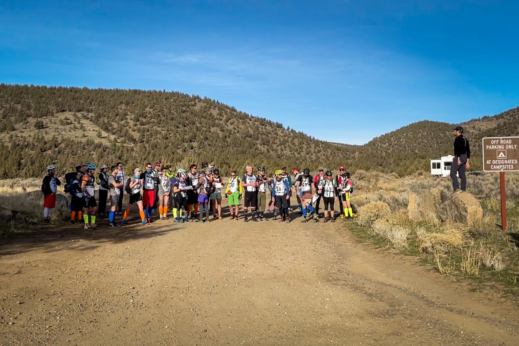
Jason (on rock) prepares us for race start

Our team, with the legacy name of “Texas Pride”, though none of us are from Texas

there goes the herd veering off to the left when we had planned to head to the right

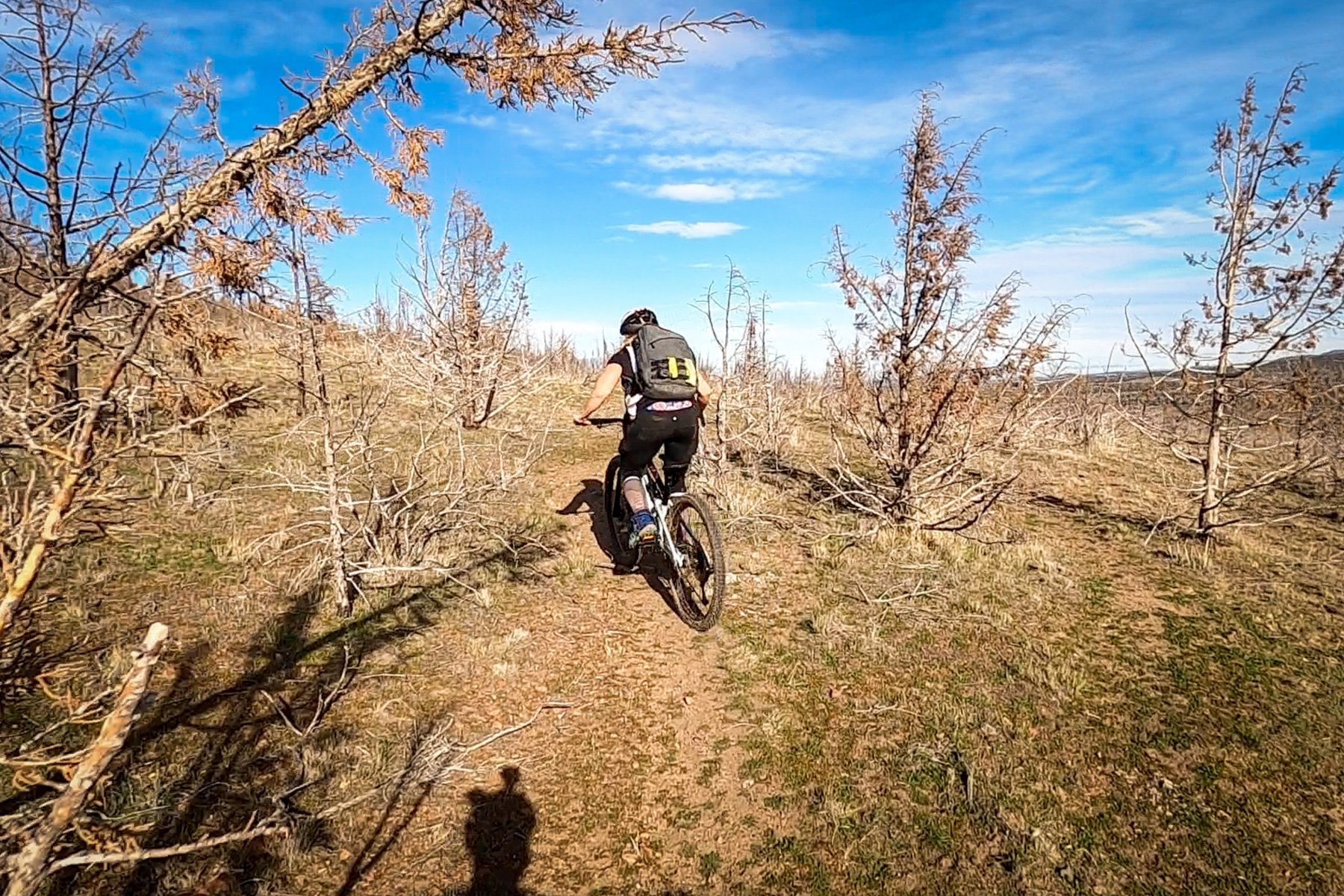
3 minutes into the six hour race


we would end up running a parallel race to this team, a group I recognized from also running a parallel race with them at my first TEC race

crossing our first of many barbed wire fences

Ernan loving it all!

While our maps made it appear that we were where CP1 should have been, we were too short in distance and feeling pretty demoralized after wandering around for far too long. Especially when its your first check point! But eventually we figured it out and were back on track to hit up CP 1, 3 and 4 before hitting the Transition Area (TA) where we would switch to biking.


CP3, “at the confluence”
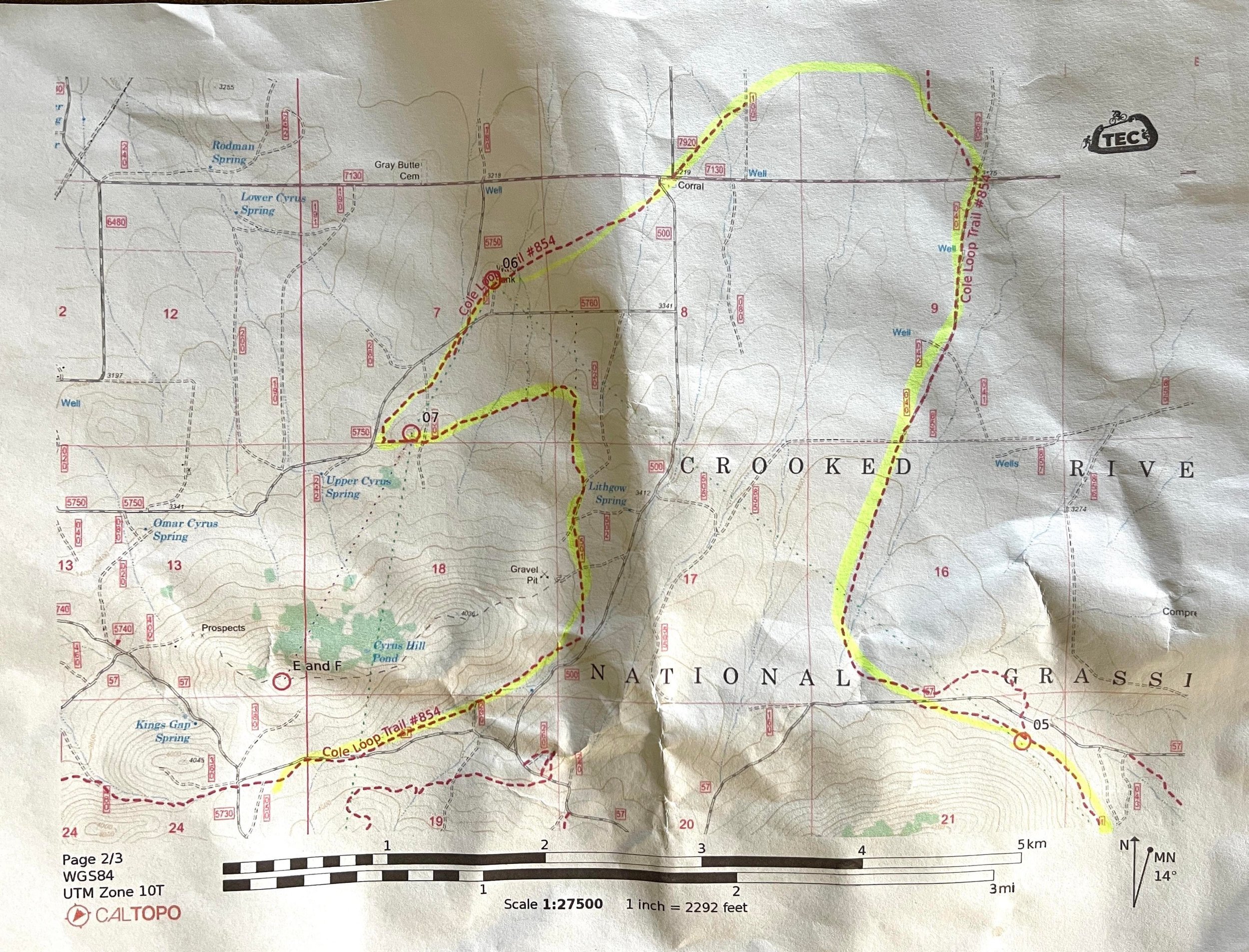
Stage II: Biking
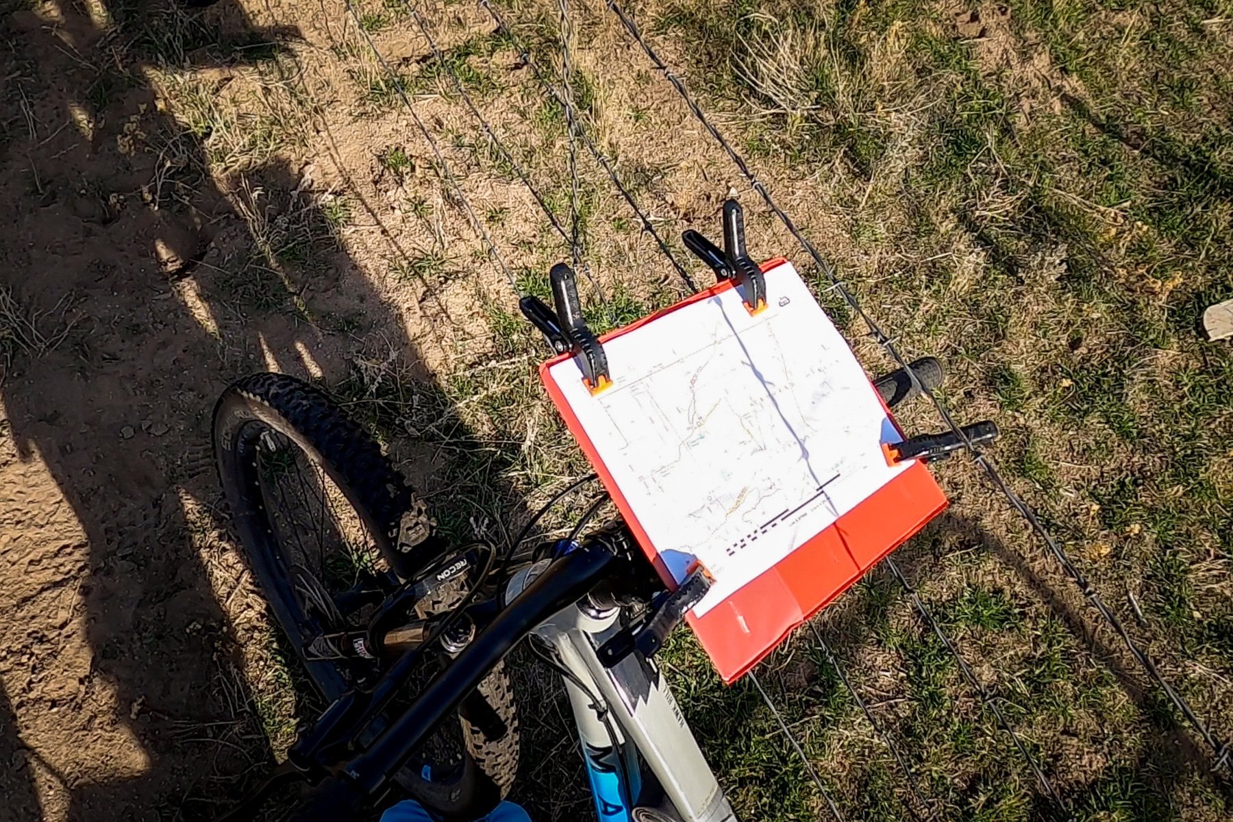
During my race this summer I borrowed a bike-mounted map board, but this time I wanted to have my own just in case I was needed with navigation. So the day before the race I found a school binder and cut the cover off, drilled a hole in it, and mounted it to a GoPro or similar accessory that was attached to my handlebars. I could slip in the paper maps and clip them on with some camera backdrop clips I had laying around. As a bonus I could even move my map board around as needed!
Barbara had a map board as well but was not confident that it would survive another adventure race. Within moments, the map flew away into the wind causing a quick chase of capture.
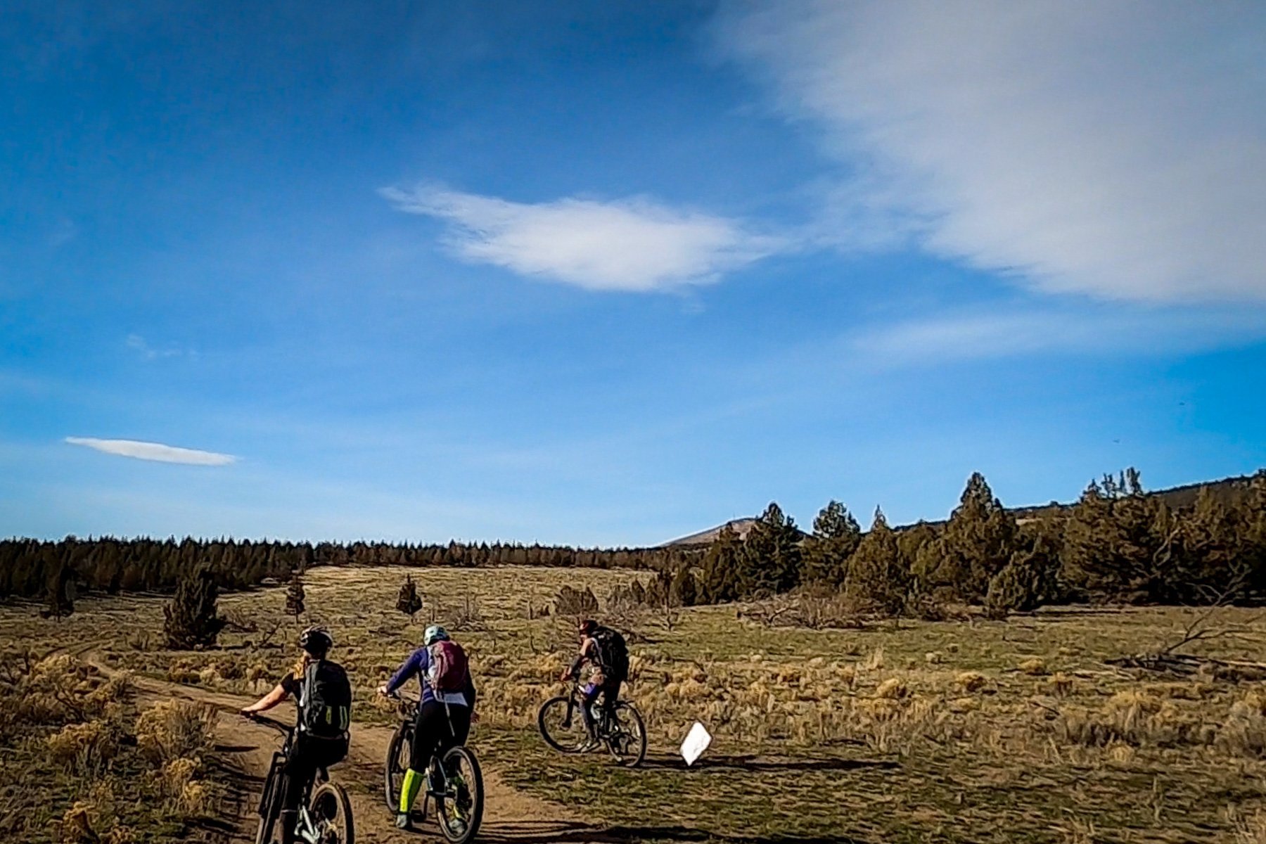
We were immediately greeted with a gradual uphill double track challenge where we would aim to connect with a single track. So far up to this point we hadn’t even met up with any other teams, so it was nice to see another team of 4 come from behind and pass us on their own pre-mapped journey that would likely look different from ours. Sure enough, they hadn’t chosen to cross the road, hop the barbed wire fence, bushwhack by bike for 100 meters or so, and meet up with another single track. Who knows what was right or wrong, faster or slower, but this was what we had chosen.

By this point in our journey we had moved on to looking for CP5. I had the maps now and navigation by bike moved into my responsibility. With no bike computer, we relied on Barbara to track distance and reset at each junction. We moved down jeep roads quickly, turning as needed onto single track, up and over hills to eventually reach another check point located on top of an old metal overturned storage tank. This, like one before it, was a non-punch C.P.. Rather than punching our passport at the right CP box, we would need to write down what the sticker said to prove we had reached it.

Ella reaches the top, with a little help from her teammates, at CP6
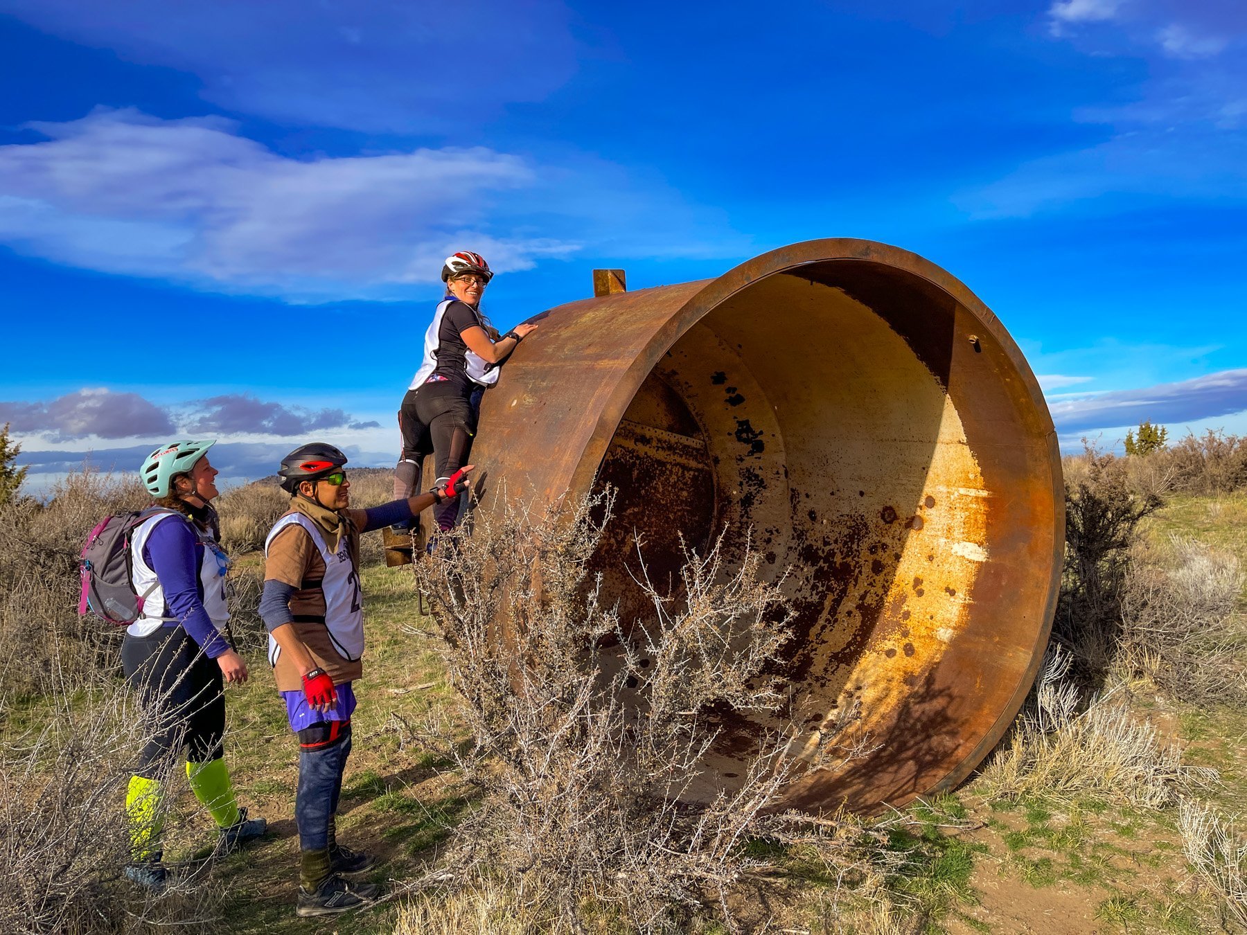

Feeling good, having found another check point
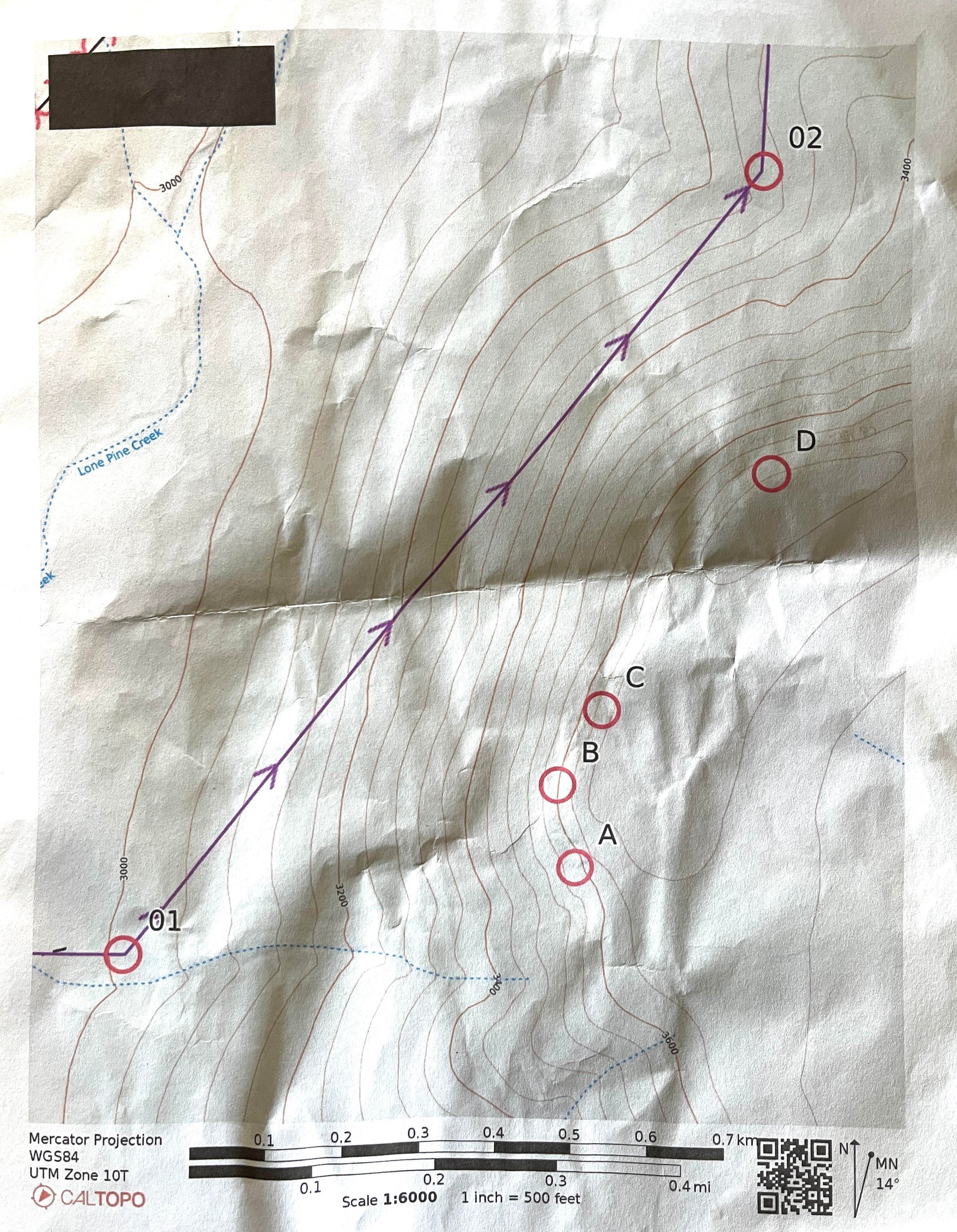
Our next checkpoint would be coming soon. We estimated it would be in 1-2KM and set out for it. But with a confusing hint that simple said “local top”, we weren’t sure what to look for. Other hints had been easier: “confluence”, “80 meters SW of junction”, etc., but we could only assume this meant it was at the top of a higher place. When we reached the horse camp, we wandered and hoped for the best but never found the check point. We knew we needed to get back onto the trail, having seen that our finish line was still 13 miles away if we followed the bike track the whole way and it was already coming up to 3PM.
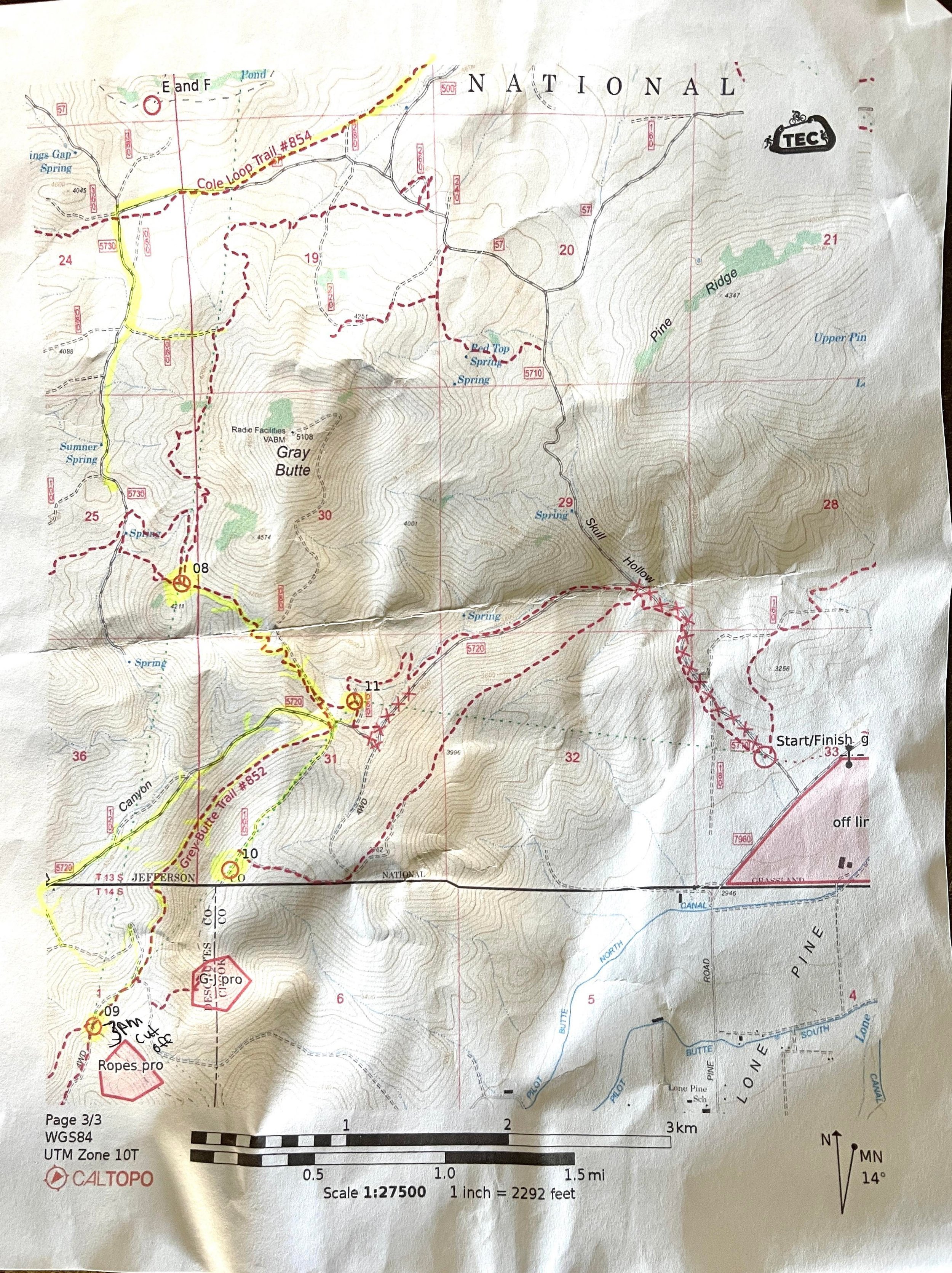
It was looking obvious that we would have to skip all other check points (8-11). We certainly would never reach CP9 and the 3PM cut off that would allow us to climb. And, like my first TEC race, we had carried climbing gear needlessly with no hope of reaching the cutoff unless we had planned to skip many of the earlier checkpoints to beeline for the climb.
We worked hard to bike the many miles to get us onto some main roads that would get us as quickly as possible to the finish, while recognizing that the final half mile or so could not be finished on the main road but had to be on the parallel single track bike path. As we got closer to the forbidden road, we tried several possible entry points before eventually landing on the bike path we needed. We were feeling more confident now that we would finish before the 4PM race cutoff but knowing we had very few checkpoints under our belt.

fast tracking it back to the finish line

our steep entrant onto the single track that would take us to the finish line
The end of a race is always welcome. I was starting to feel a bit of concern around 3PM hoping we wouldn’t get stuck in the dark. I hadn’t prepared for any darkness, making mental notes to always attach my bike lights in the future as well as a headlamp in my day pack. We milled around with other racers and cooked hotdogs over the fire while enjoying sugary snacks and hot cocoa.
In the 24 hours to come we would process what went well and what we could have improved upon, eager to continue to improve knowing that clearing the course IS possible even if you aren’t an elite racer. That’s one of the many beauties of adventure racing. To prove the point, long time racers who were easily middle aged had, for their first time, cleared the course and no doubt felt a wonderful sense of accomplishment. #goals
What worked:
we had great team dynamics and all got along well
my map board worked for the most part, though I would switch out the clips with long rubber bands in the future (did not test in wet conditions)
my bike navigation for the most part went well given the deficiencies of the map
the Garmin Fenix 6s Pro did great tracking the race!
What didn’t:
didn’t need the added weight/frustration of the sling bag over my neck that contained climbing gear I never used
we went with the herd at race start instead of running our own race
we didn’t take the time to pace count well during the trekking portion at first
I need to learn how to pace count on foot (ranger beads)
I need to learn how to use the compass better
still want to improve my base level of fitness, though for this race my pace was pretty equal to my teammates
I wasn’t prepared for the dark
I probably didn’t eat or drink enough, though I didn’t feel anything negative. Had I packed something fun and real instead of pre-packaged trail stuff, I would likely have been more inspired to eat.
My GoPro was not reliably starting/stopping recording with voice activation, so I need to mount it to my bike instead and use the buttons or at least take it off my helmet so I can see what I’m shooting and know when I’m recording
as the race goes on, I forget to record our decision making process